Aaittafama' Archaeological Park History
Archaeology of the Site
Methodology and Findings
Archaeology is the way we learn about past peoples and the lives they led. It is a scientific discovery process in which the archaeologists collect physical evidence on various human activities. On a prehistoric site, the evidence includes artifacts, discolored soil from decayed posts, fire hearths, storage and refuse pits with discarded bones and plant remains, and sometimes human remains. All of the excavated evidence is used to reconstruct past activities.
 |
In 1972, the archaeological site was first recorded in the Tennessee Division of Archaeology (TDOA) site records as number 40 WM 10. The numbering system shows the state (40), the county (WM) for Williamson, and the sequential number (10). The initial report was based on artifacts found in a garden plot with possible prehistoric graves. The site boundary was not determined but it was obvious that Hillsboro Road had crossed the site in the 19th century, and that the site also extended into Davidson County. The property was owned by the Kelly family who had lived there since the 1830s.
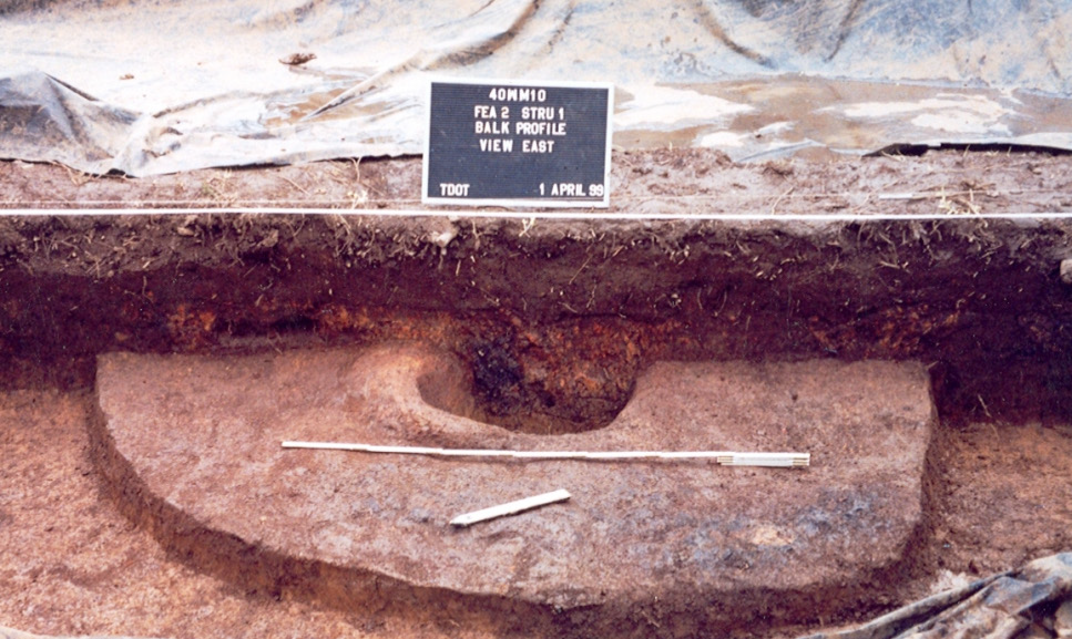
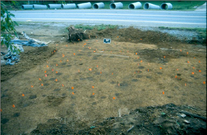
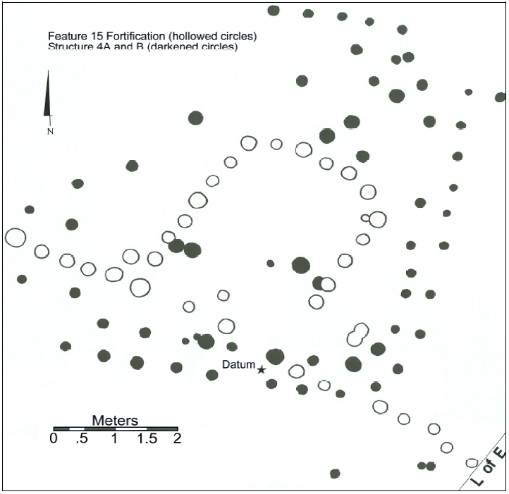
In 1999, Tennessee Department of Transportation (TDOT) and TDOA archaeologists excavated the construction impact area associated with a proposed new turning lane on Hillsboro Road (Barker and Kline 2013). They uncovered and mapped the post patterns of 12 houses, fire hearths, and 7 child’s graves in stone-lined rectangular pits. The graves were left intact pending further legal actions. They also found the post holes associated with two distinct inner and outer palisade lines, which represent different stages of expansion of the town. Radiocarbon dates established that the site was occupied from around 1240 CE to 1440 CE. The site was named Kellytown for owner Elizabeth Douglass Levine Kelly who gave permission to test the site.
 |
 |
 |
The construction project was delayed for several years while the disposition of the affected graves went through lengthy court hearings. In the end, TDOT decided to leave the graves in place, protect them with concrete, and construct the turning lane over them.
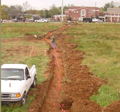
The Kelly family sold seven acres of the north end of the site and Mr. Barker was retained to trace the eastern extent of the outer palisade. This palisade marks the northern boundary of the archaeological town.
In 2014, Metro Nashville Parks department acquired the seven acres with the support of Friends of Kellytown, a non-profit group. The Friends funded an additional archaeological study as part of the preparation of a master plan for the park. In June and July 2015 Cultural Resources Associates (CRA) conducted remote sensing research using a sensitive magnetometer and ground penetrating radar (Bradbury 2015). They confirmed the outer palisade but did not indicate extensive features or occupation between the outer and inner palisades. This surprising result may have something to do with the late date of the outer palisade. A charred bean in one of the post holes was Carbon-14 dated at 1420 CE.
Future research at this site has the potential to answer some of the biggest questions in Tennessee archaeology, namely what caused the collapse of Mississippian culture around 1450 CE. Its preservation as a park will permit a long term approach to research.